
Open Lands Plan calls for more trails, trailheads for ADLC's recreation areas
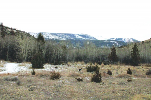
A dog can be seen scampering from a snow-covered trail back to its owner in the area near the Stumptown Road trailhead. More trails and trailheads are recommended for development in the uplands on both the A-Hill and C-Hill and on Stucky Ridge under Anaconda-Deer Lodge County's Open Lands Plan, part of its preparation for about $4 million in funding from the Natural Resource Damage Program for recreation and wildlife habitat on lands impacted by the smelter. Leader photo: James S. Rosien
Plan includes nine new or expanded trails in uplands on both sides of town
Anaconda-Deer Lodge County is gearing up for the coming infusion of about $4 million in Natural Resource Damage Program (NRDP) funds for recreation and wildlife habitat development on soon-to-be-public lands that were impacted by the smelter, and its Open Lands Plan is calling for both new and improved trail systems on the north and south sides of town.
In response to the public's wishes for more hiking, walking and biking opportunities (see the Jan. 26, 2024 Anaconda Leader), the plan recommends adding a major new trail network to Stucky Ridge and the Lost Creek area in the form of four new trails that, taken together, would span over 10 miles.
The first trail, aptly named "Bowling for Stucky Ridge," would expand and improve upon the existing trail behind Cedar Park Lanes, taking it north to where it would meet a completely new trail, the three-mile "Stucky Explorer" loop that would explore existing drainage areas that have been inaccessible for years, and a "Backside Loop" that would connect the two via new terrain. A fourth trail, "Moto Loop A" entirely on the Lost Creek side, would be for motorized use only and would offer acces to the existing Motocross Park. The plan specifically recommends such a trail as motorized usage often is viewed as incompatible with hiking and biking for reasons including safety, noise and wildlife.
Even bigger in scope than the Stucky Ridge and Lost Creek plans are the recommendations for the A- and C-Hills, which would see five new and/or expanded trails extending about 11 miles throughout the two hills to Anaconda's south.
The first trail, "A-Hill West Summit," would have a switchback design connecting with existing trails, while the second, more direct summit of the A-Hill, would connect to both existing trails and the C-Hill. A third A-Hill trail, "A-Hill to Sheep," would connect with Sheep Gulch Road and also offer C-Hill access. As to the C-Hill itself, a massive six-mile new trail loop would offer access to the backside of the C-Hill and loop back to Sheep Gulch Road. The fifth trail, "C to Shining C," is another new trail, albeit a smaller one about a mile long, that would loop the backside of the C-Hill in with Mill Creek.
And you can't have new and improved trails without new and improved trailheads. To that end the plan recommends the addition of a motorized trail near the existing Motocross Track that would connect to the proposed motorized trail on the Lost Creek side of Stucky Ridge.
The plan further recommends the addition of a new trailhead behind the ADLC Courthouse, one with at least 15-25 parking spaces, permanent toilets and interpretive and instructional signage. This trailhead could be built on county-owned land on the west side of Sheep Gulch Road near the cemetery.
Though there's no suitable place to add parking, the top of Birch Street could see the addition of features like a kiosk with wayfinding signs and maps to serve as a trailhead.
The intersection of Anavista and Sunnyside roads on the west side of town near Mitchell Stadium could see the addition of a trailhead with parking spaces, or as an alternatiev the intersection of Willow and West 7th streets across from the baseball field would offer another existing access point for the A-Hill and could accommodate a small trailhead with angle parking.
The plan also recommends future improvements to the existing trailhead near Cedar Park Lanes, such as striping, toilets and wayfinding an interpretive signage, and notes the potential for converting railroad track adjacent to Washoe Park into a trail, though as there's private property intersecting that there would first need to be an easement agreement before such a trail could exist.
As for wildlife habitat, the plan calls for extensive aspen enhancement on both the north and west sides of the C-Hill and erosion control and steep slope revegetation and trailside revegetation throughout both Stucky Ridge and the A- and C-Hills. The sites would also see some floodplain and wetlands enhancement. There would also be areas marked for closure to allow for intensive native revegetation to occur.
The plan was presented to the ADLC Commission at their Jan. 23 meeting and will be up for approval at their next meeting on Feb. 6, though it's important to note that, if approved, it would be a long-term project that would be implemented in two-year phases over the next six years. The complete Open Lands Plan is available online at https://www.adlc.us/DocumentCenter/Index/328. For more information, contact the ADLC Planning Department at (406) 563-4010.
Category:

